Surveys and Mapping
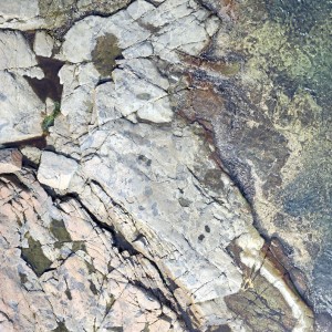
Cloudbreaker can collect survey-grade 3D data and high-resolution imagery at a fraction of the cost and time of traditional methods. Using photogrammetry and other sensors/methods in low altitude flights, we can produce a highly-detailed map of your area. We attach RTK survey points to a mosaic dataset for a ground resolution of less than 5cm/px! Moreover, our unmanned aerial vehicles can cover large areas quickly and reach tricky locations with GPS-controlled autopilot systems to keep crews safe.
We can provide:
- Orthomosaic Images (<5cm/px)
- 3D point clouds
- Digital surface models (DSM)
- Volumetric calculations
- Ground cover classifications
- Drainage and flood mapping
- Agricultural mapping
- Property/development mapping

